
West Palm Beach-Fort Pierce Area Forecast: Minimal Rain Today, Wetter Pattern Midweek, High Rip Current Risk
The West Palm Beach-Fort Pierce area is forecast to have minimal rain chances today, with a wetter pattern expected to begin midweek and continue through Friday, bringing scattered showers and thunderstorms. Beachgoers should be aware of a high rip-current risk.
 West Palm Beach Fort Pierce, FL, September 28, 2026 —
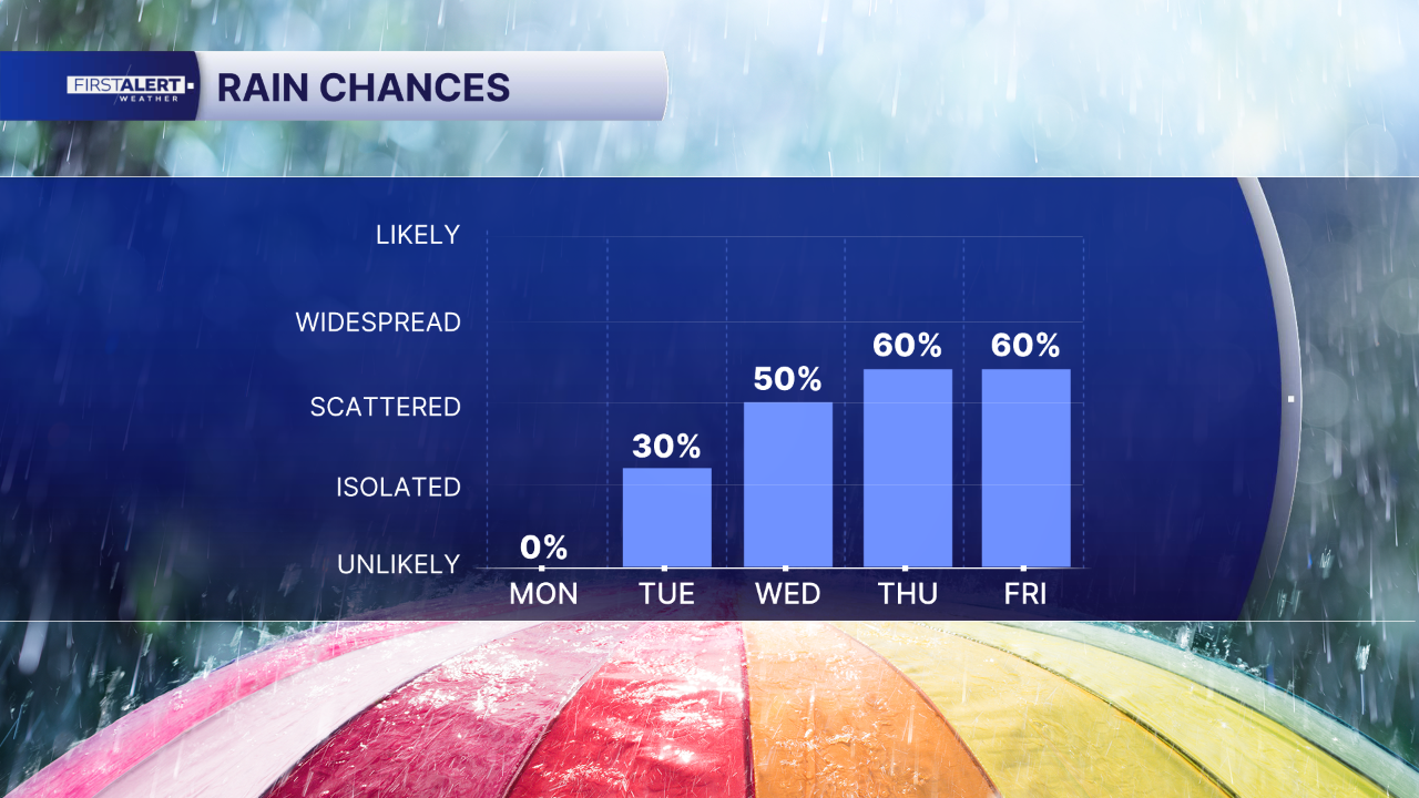
The West Palm Beach-Fort Pierce area can expect minimal chances of rain throughout today. However, weather patterns are set to shift midweek, ushering in a period of increased precipitation that is forecast to persist through Friday.
The anticipated change will bring scattered showers and thunderstorms to the region starting around Wednesday. This wetter pattern is expected to continue for the remainder of the week, offering a departure from the dry conditions anticipated for today.
In addition to the changing precipitation forecast, beachgoers in the West Palm Beach-Fort Pierce area are advised to exercise caution due to a high rip-current risk. This warning indicates potentially dangerous conditions for swimmers and those engaging in water activities along the coast.
Specific details regarding the intensity or timing of individual storms, or the exact duration of the wetter pattern beyond Friday, were not provided. Residents and visitors are encouraged to stay informed about daily weather updates from local meteorological services as the forecast evolves.
Story summarized from the original created by Walter Kelley on www.wptv.com, see more information here.
Media gallery

