West Palm Beach-Fort Pierce Forecast: Breezy Conditions, Spotty Showers, and Rising Flood Threat
West Palm Beach-Fort Pierce is experiencing a forecast of breezy conditions with spotty showers and thunderstorms continuing through Friday. Higher moisture levels are expected over the weekend and into early next week, increasing rain chances and posing a threat of…
 West Palm Beach Fort Pierce, FL, September 17, 2026 —
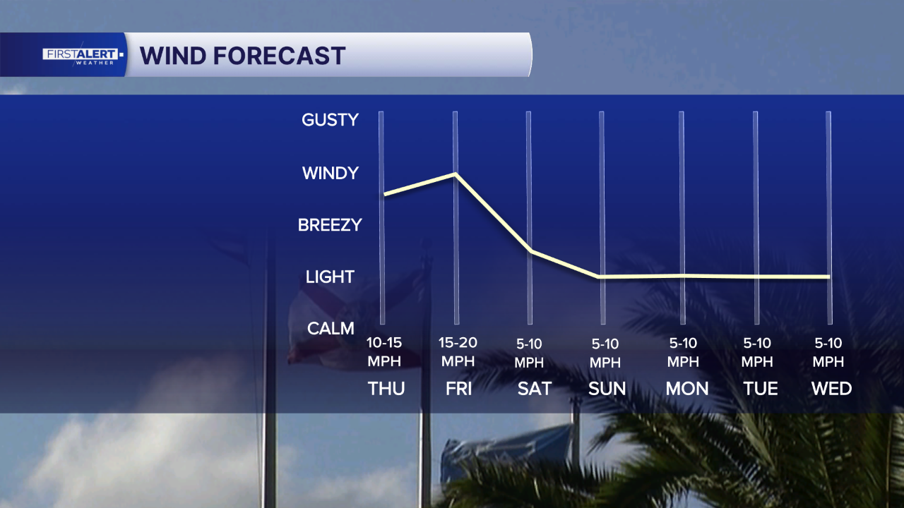
Residents and commuters in the West Palm Beach-Fort Pierce region can expect continued breezy conditions through Friday, accompanied by scattered showers and thunderstorms. The weather pattern is set to shift over the weekend, bringing an increase in atmospheric moisture.
This anticipated rise in moisture levels is projected to elevate the chances of rainfall starting this weekend and persisting into early next week. Meteorologists are closely monitoring the situation, as the increased precipitation could pose a risk of localized flooding.
The primary concerns highlighted by the forecast include the potential for urban flooding and issues related to poor drainage systems. These conditions can lead to disruptions in traffic and daily activities. Specific details regarding the intensity or duration of the expected rainfall beyond the general increase in chances were not provided in the forecast summary. Similarly, the exact timing of when the higher moisture levels will begin to significantly impact the area was not specified.
The forecast indicates that the weather pattern will evolve from the current state of breezy conditions and isolated storms to a more unsettled period. While spotty showers and thunderstorms are expected to continue through Friday, the overall chance of rain and the potential for more widespread or significant precipitation is forecast to increase as the weekend progresses and into the following week.
Officials are advising the public to stay informed about weather updates as the situation develops. While specific warnings or advisories have not yet been issued based on this summary, the increased probability of rain and potential for flooding warrants attention. Further information regarding the specific impacts on the region will be provided as the forecast is updated.
Story summarized from the original created by Sami Squires on www.wptv.com, see more information here.
Media gallery